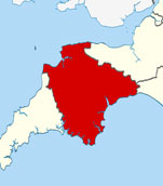
Map of Bigbury-on-Sea Devon and Surrounding Areas
Detailed street map of Bigbury-on-Sea village centre and the surrounding areas, towns & villages.
 |
||
Bigbury-on-Sea Map Devon Showing the Village and its Surroundings
Street Map of the Devon Village of Bigbury-on-Sea: Find places of interest in the village of Bigbury-on-Sea in Devon, England UK, with this handy printable street map. View streets in the centre of Bigbury-on-Sea and areas which surround Bigbury-on-Sea, including neighbouring villages and attractions such as Challaborough, Bantham and Ringmore. Large Bigbury-on-Sea map.
Highlights of This Bigbury-on-Sea Devon Map:
- Easy to Print Map for Village Centre of Bigbury-on-Sea.
- Get a Satellite View of Bigbury-on-Sea.
- Find Routes To and From Bigbury-on-Sea area.
- View Villages and Towns Around Bigbury-on-Sea Devon.
- Identify Bigbury-on-Sea Areas of Interest.
- Find Hotels and Accommodation Near Bigbury-on-Sea.
- Easily Find Bigbury-on-Sea Tourist Attractions.
- Zoom in, Pan and Move Around Bigbury-on-Sea.
- Locate Local Caravan Parks and Holiday Parks.
Locate streets and roads in and near Bigbury-on-Sea, locate interesting places and attractions in and near Bigbury-on-Sea, locate towns and villages surrounding Bigbury-on-Sea area.
- Map of Gunnislake Area and Surroundings Devon
- Map of Woodbury Area and Surroundings Devon
- Map of Parkham Area and Surroundings Devon
- Map of Thurlestone Area and Surroundings Devon
- Map of Devonport Area and Surroundings Devon
Villages and towns surrounding Bigbury-on-Sea in Devon include: Challaborough, Bantham and Ringmore.
England Town Maps - Cornwall Maps - Wales Town Maps